Land Art: From Mono Lake to Death Valley
Temporary Land Art Installations made at four different sites. Each is described below.
These temporary land artworks were created during a group land art trip in 2000 - we retraced the ancient waterway that flowed from Mono Lake to Death Valley during the last ice age. All works were done on site; they were temporary installations documented in these photographs.
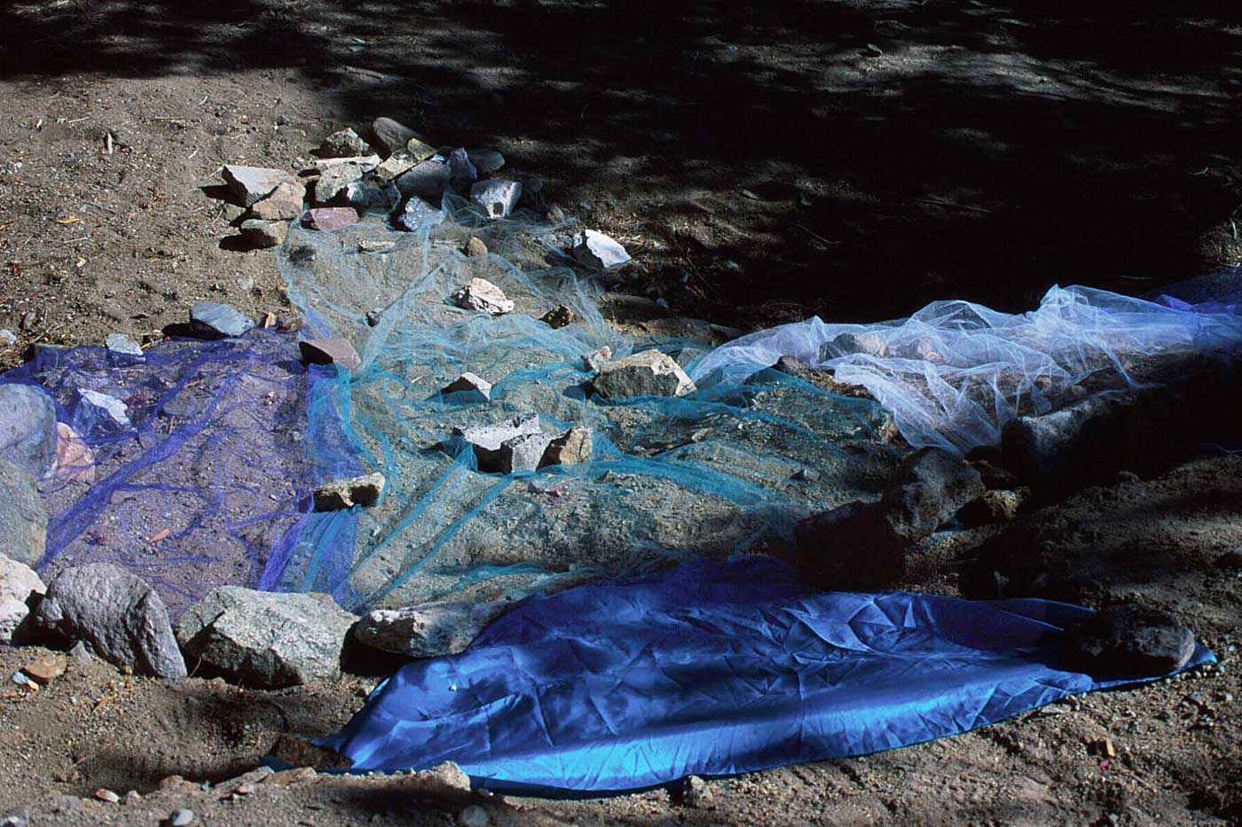
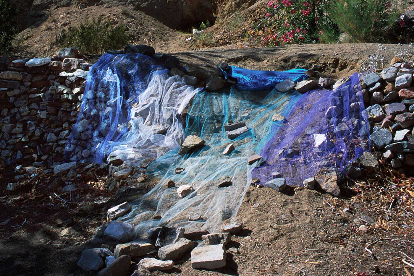
My land art works involved re-creating water features where there is no longer water. I chose to work in fabric because it lends itself naturally to looking like water. I used nylon tulle dyed royal blue, purple, turquoise, seafoam green and white, The tulle is a sheer fine mesh which has the property of being translucent in a single layer and shows the color it's dyed when it's in multiple layers (such as when it is bunched together).
You may also want to view my other series of temporary land artworks created during another group land art trip in 2001 that focuses on ancient Lake Lahontan, a vast system of interconnected lakes that filled the central Great Basin of Nevada during the last ice age.
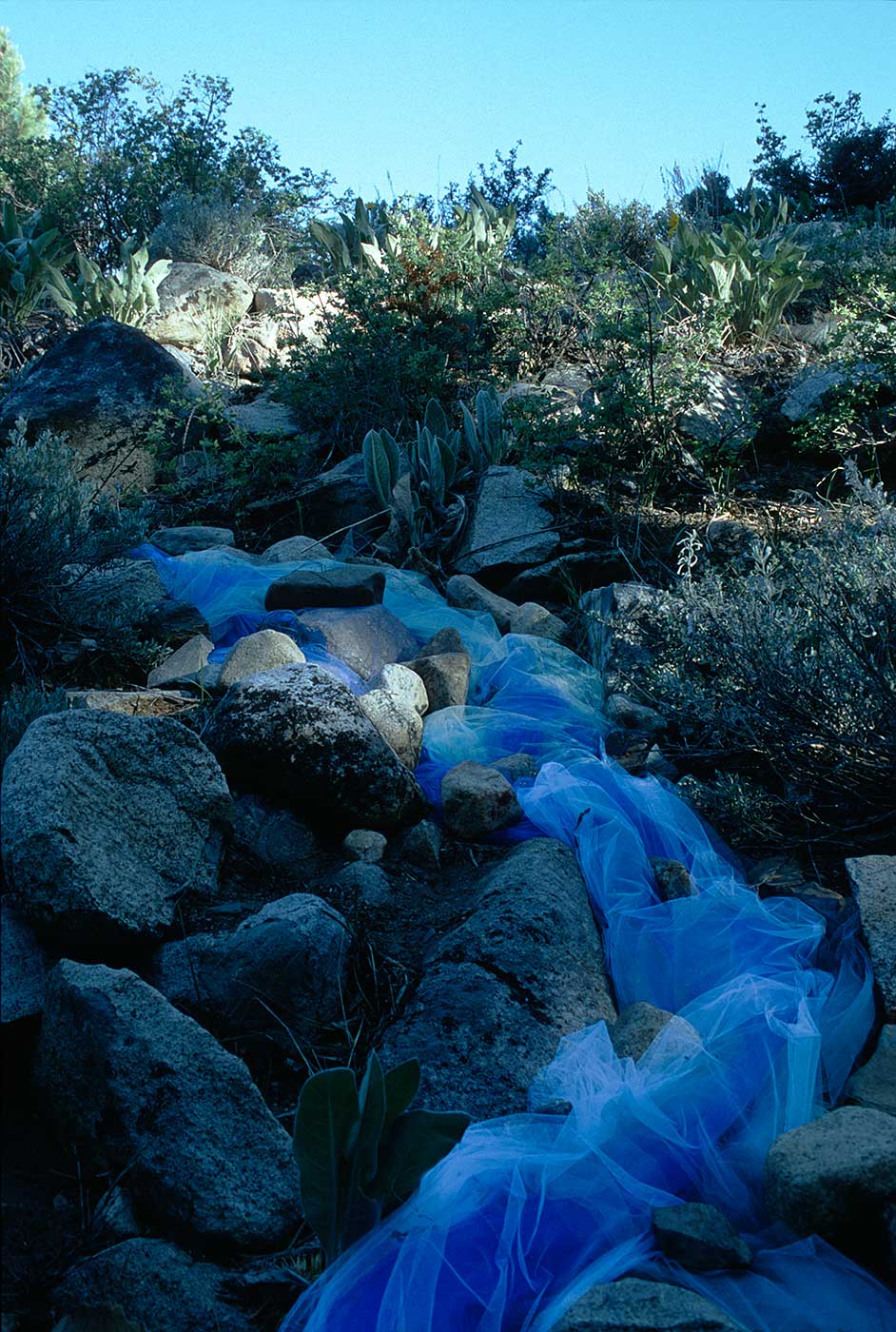
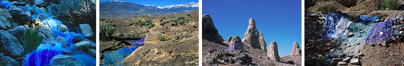
Title: Rivulet At Parker Creek
Date: May 25, 2000 elevation 7800'
Statement: The water in Parker Creek, a tributary of Mono Lake, has been diverted to the Los Angeles Aqueduct and therefore much of its creek bed is dry and its water no longer makes it to the lake. This flow of fabric was constructed on the glacial moraine next to Parker Creek to represent both the presence and absence of water. On the one hand it represents the glacial melt during the Pleistocene, which flowed down to fill the Mono basin. On the other hand, it represents the modern-day water from that watershed, destined for Mono Lake, that never makes it there. The transparency of the tulle symbolizes the ephemeral quality of water.
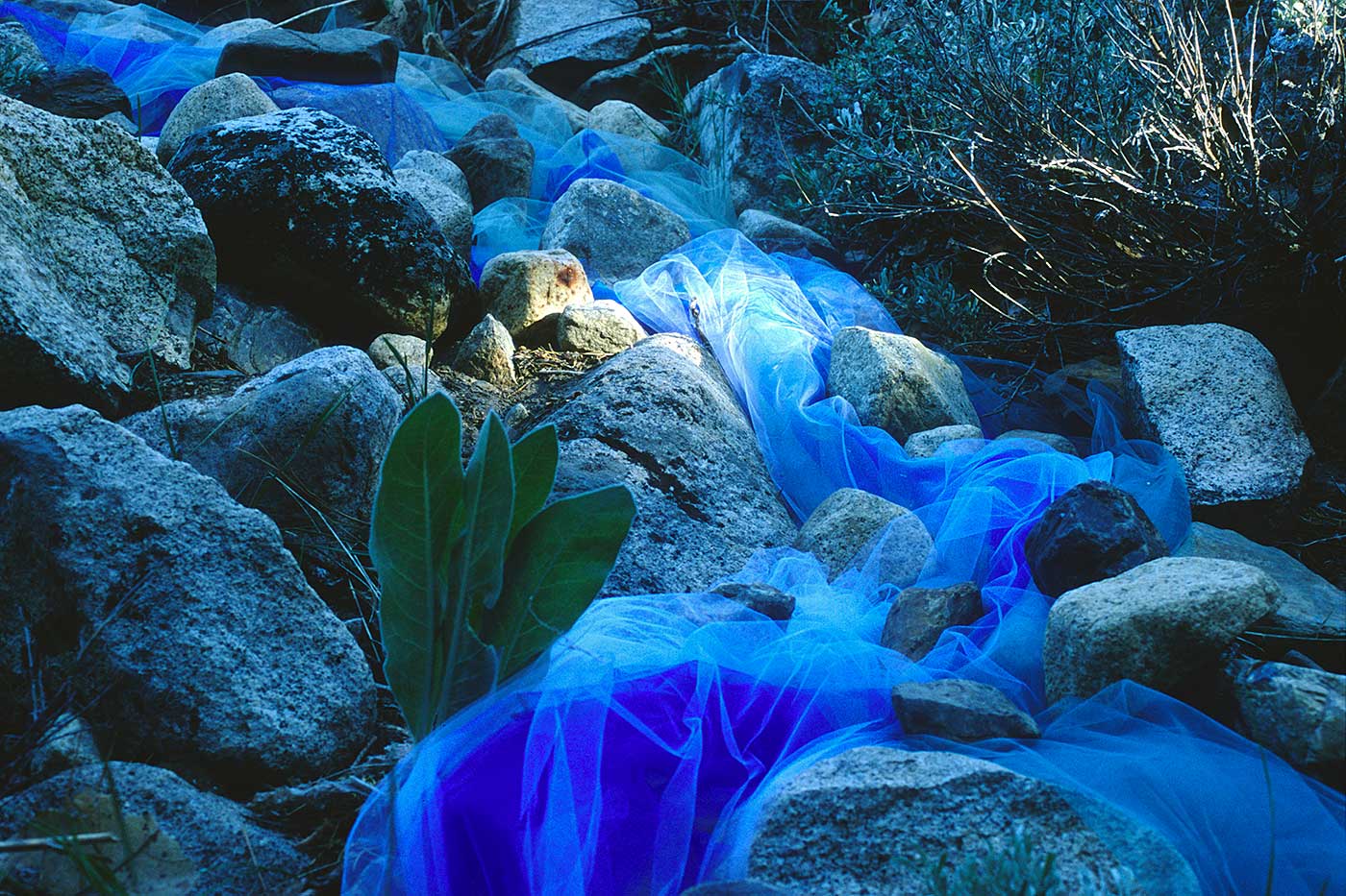
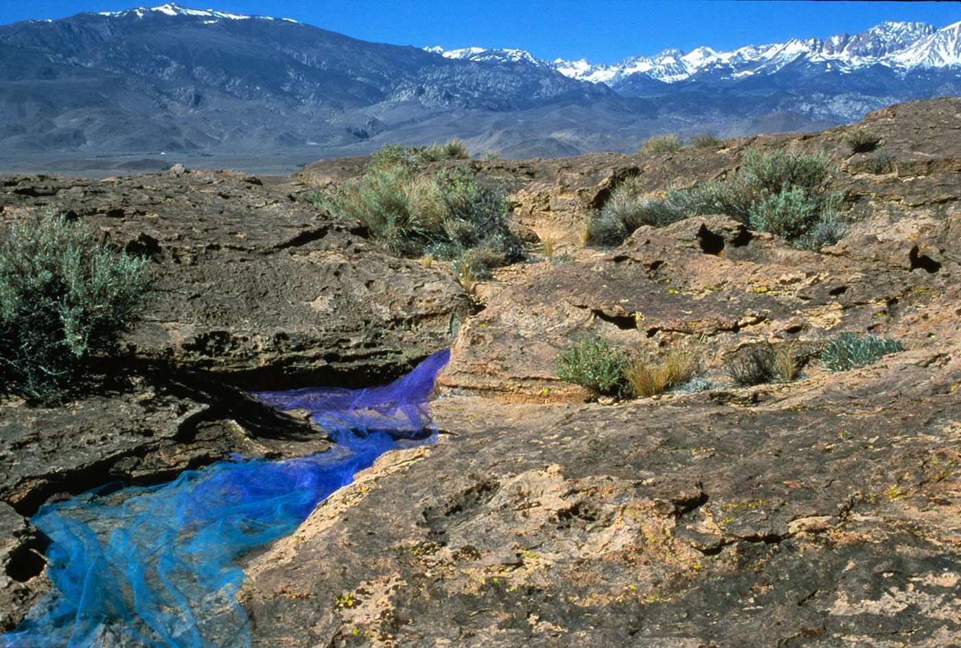
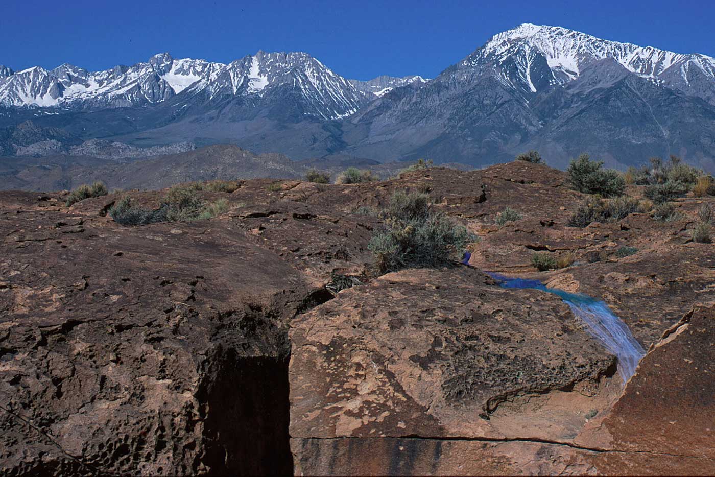
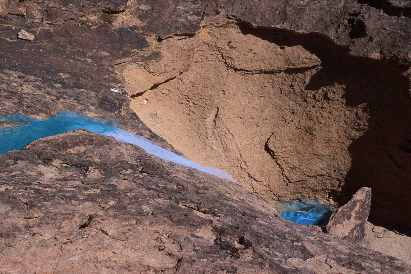
Title: Water Entrapment at Owens River Gorge
Date: May 26, 2000 elevation 4520'
Statement: The Owens River Gorge is the site of significant human intervention in the Ancient Waterway. This installation was a collaboration with Jim Feuhrer. We reconstructed a water flow of fabric, near the cliff edge of the Bishop Tuff, in a naturally eroded waterway and created a dam in a natural pool. The dam was constructed intentionally smaller than the pool itself to increase the tension created by this intervention - the visual disruption is symbolic of the man-made disruption. We also used the color of the fabric to signify the changing velocity of the water as it flows downstream - the lighter the color, the faster the flow.
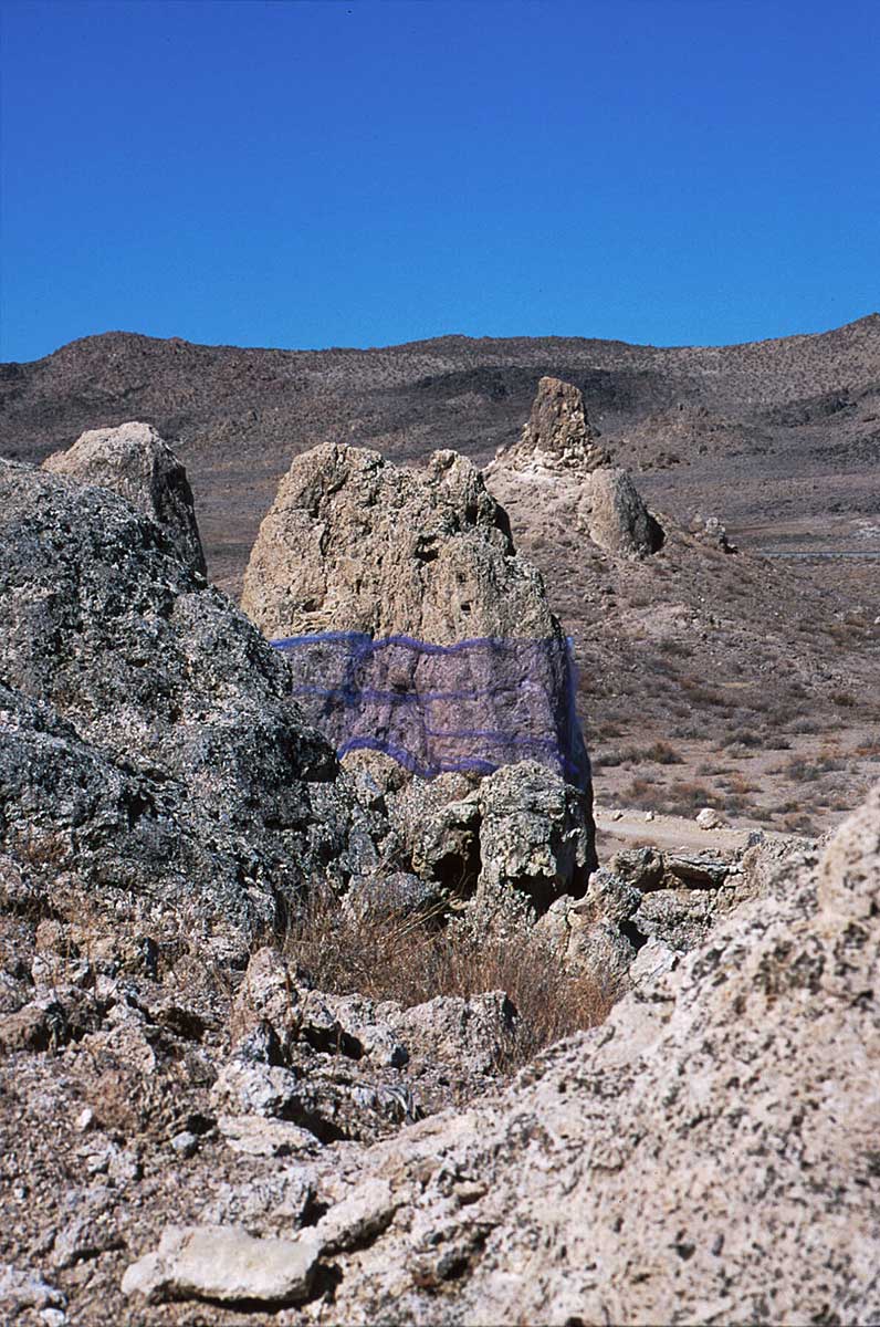
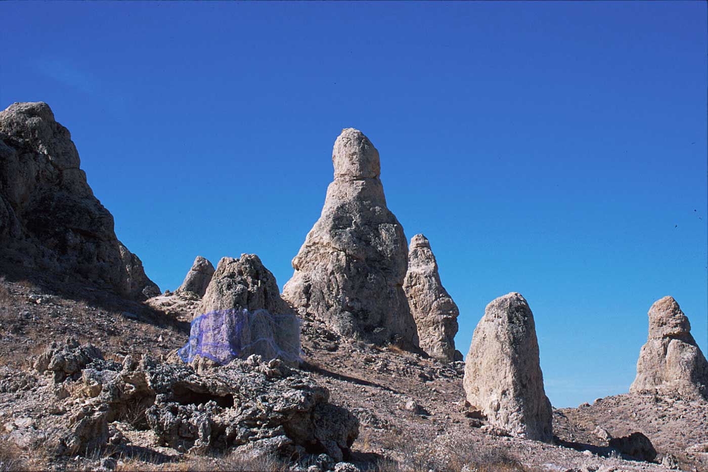
Title: Water Level At Trona Pinnacles
Date: May 27, 2000 elevation 1920'
Statement: Trona Pinnacles are tufa spires, some as high as 140 feet, rising from the bed of the now dry Searles Lake basin. I wrapped a pinnacle in fabric to make an imaginary water line and to suggest the water currents in the former Searles Lake. I chose a smaller pinnacle so I could work to scale with the fabric I had available. The fabric stuck to the sharp points of the calcium carbonate, and I imagined the creatures and plants inhabiting the lake sticking to these pinnacles as well. I let the surface of the pinnacle guide me as to how to place the fabric to create the waterline.
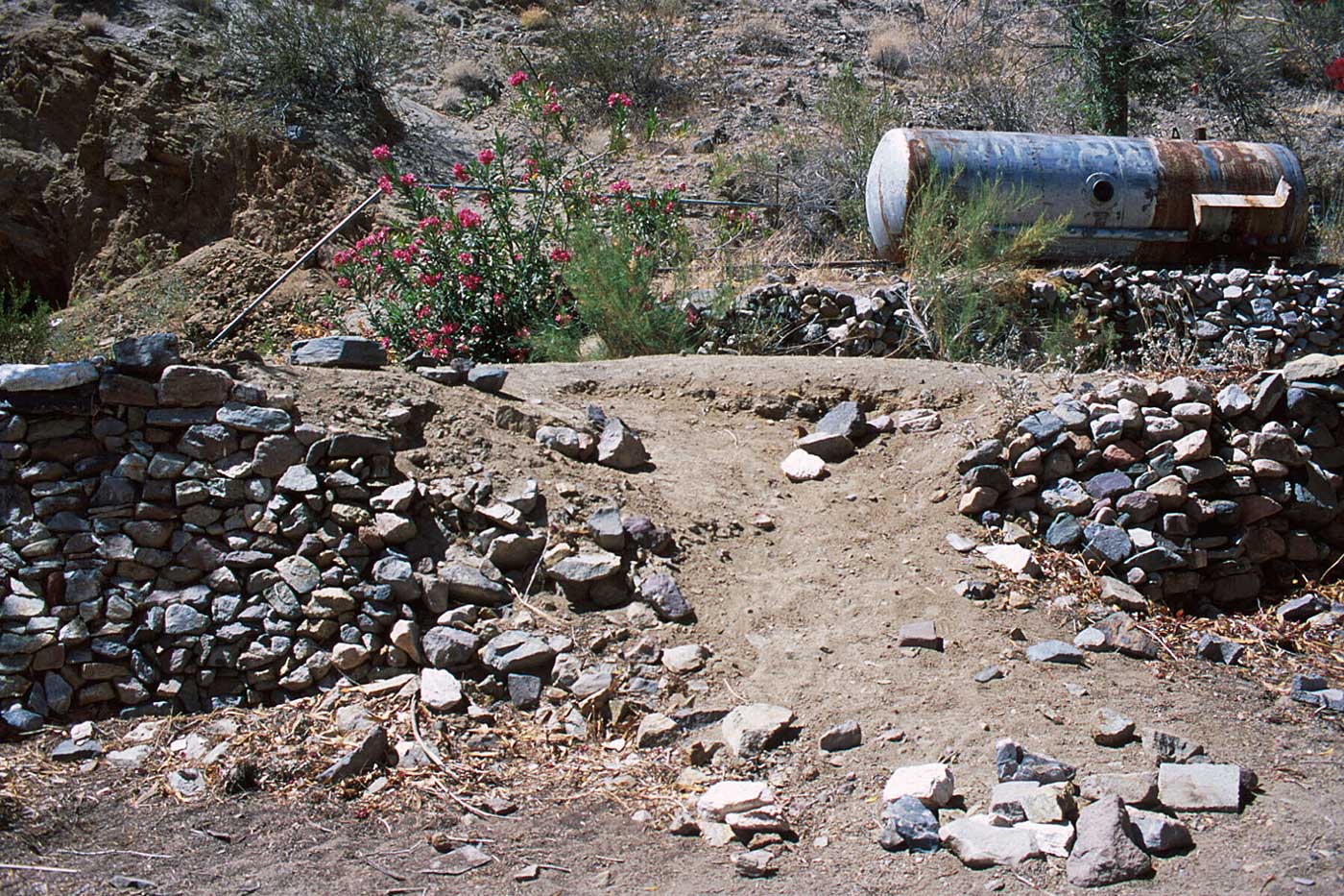
Title: Dam Break At Warm Springs, Death Valley
Date: May 26, 2000 elevation 4520'
Statement: While wandering the abandoned mining camp in Warm Springs near Death Valley in search of a site and inspiration, I found myself drawn to this dry stack stone retaining wall. As I examined the wall, I found a section where the wall had partially collapsed, and a human footpath had developed in the fallen dirt. As I started draping fabric on the wall, the attraction to it became clear to me: I had been deeply moved by the description of two serious dam breaks which occurred as part of the Los Angeles Aqueduct project where many lives were lost. I grew up in Los Angeles and was shocked to learn of this as an adult; it never made it into any of the California history lessons I had in elementary school. This installation is a re-creation of one of the dam breaks.