Pacific Crest Trail with Summit of Mt. San Jacinto, June 4-7, 2024
From June 4-7, 2024, we hiked a 27.5-mile section of the Pacific Crest Trail. Adding in bonus miles for sidetrips, we hiked 47.2 miles. We got a ride to the trailhead on Highway 74, south of Idyllwild, and ended at Humber Park near Idyllwild, where we had left our car. Side trips included a summit of Mt. San Jacinto, visiting the Taquitz Peak Fire Lookout Tower, camping in Taquitz Valley, and getting water from springs.
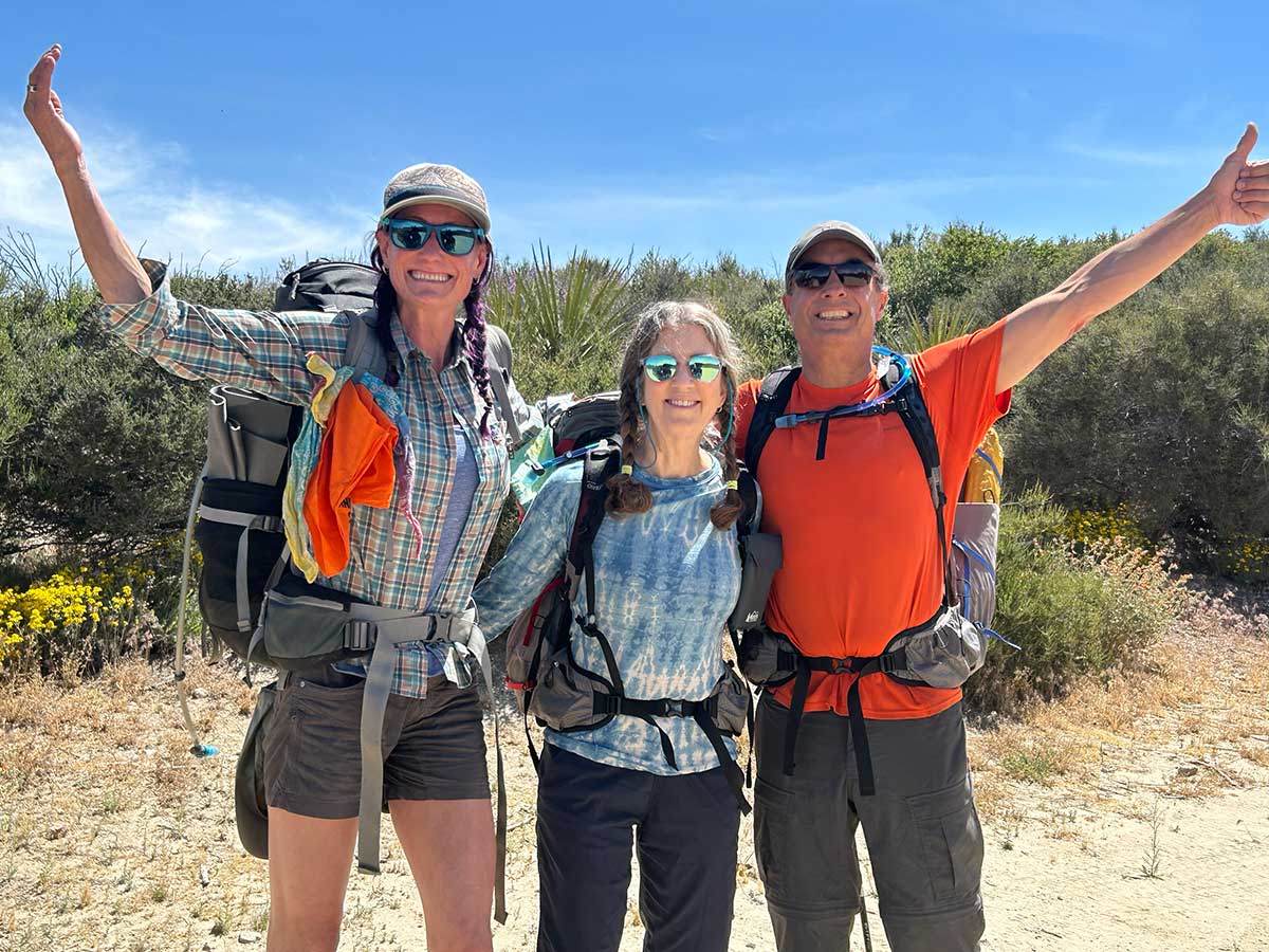
Excited to start our trip
We invited our friend Cat to join us on this trip and here we all are at the starting trailhead off of Highway 74
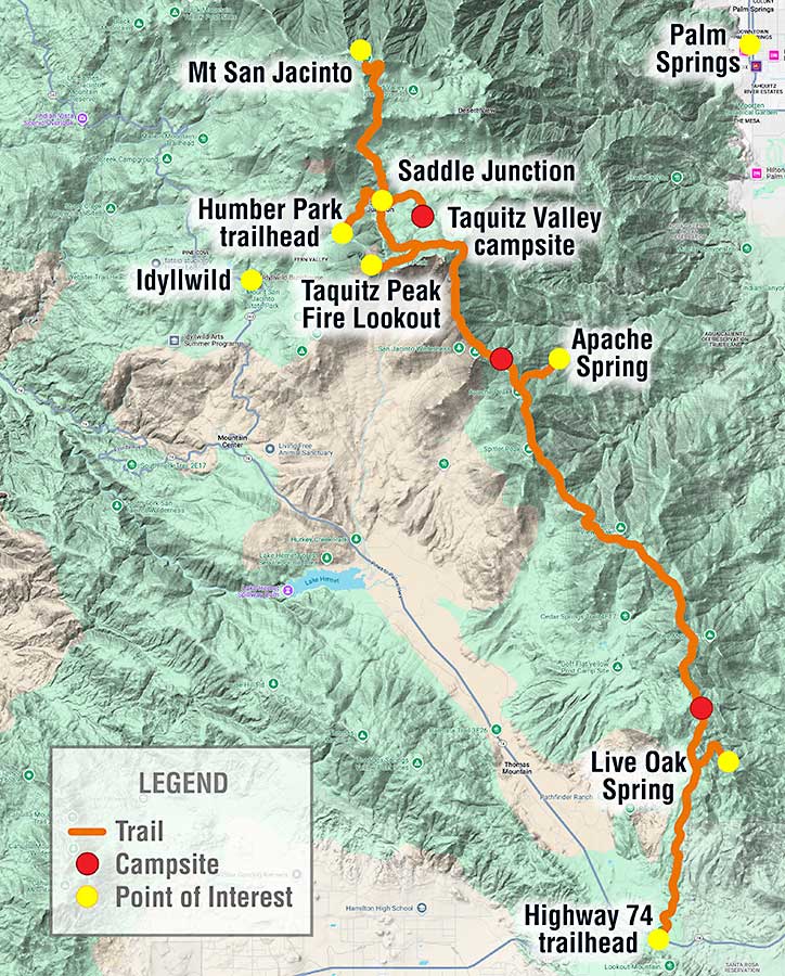
Map of our trip
The trail we hiked is shown in orange, points of interest (including the town of Idyllwild and Palm Springs) are identified with yellow dots, and the places we camped are identified with red dots.
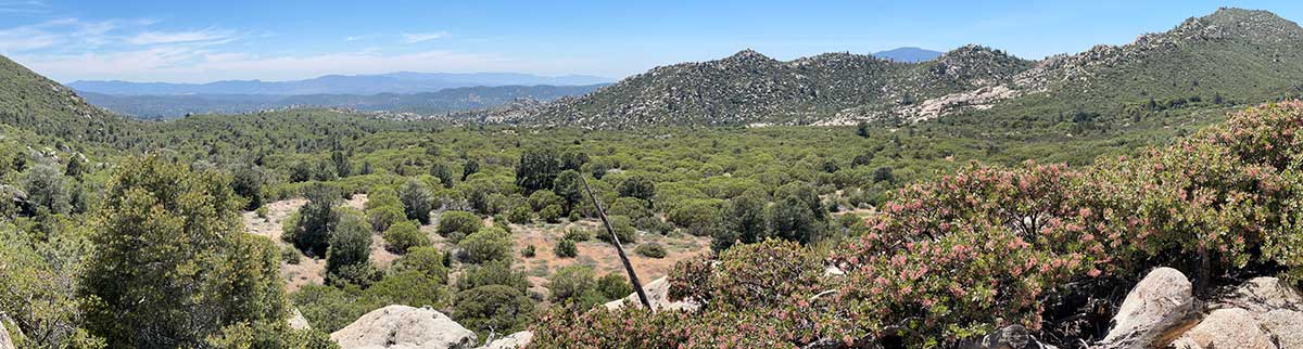
Verdant Desert
The trail was a mix of desert and chapparal landscape. Since it was early June in a year when Southern California has received a lot of rainfall, the landscape was still very green and we were treated to wildflowers in bloom.
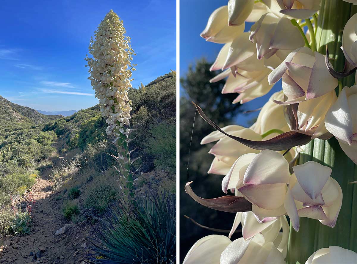
Yucca bloom
The landscape along the trail was dotted with yucca plants in bloom. I've included this closeup to show the delicate beauty of the flowers.
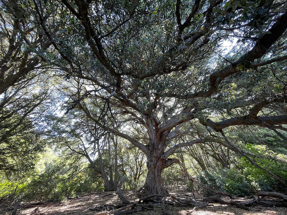
Where we had hoped to camp
The majority of our water sources on this trip were a mile hike down side trails, downhill to a spring. We had hoped to camp near Live Oak Spring on our first night, under this large majestic oak tree but...
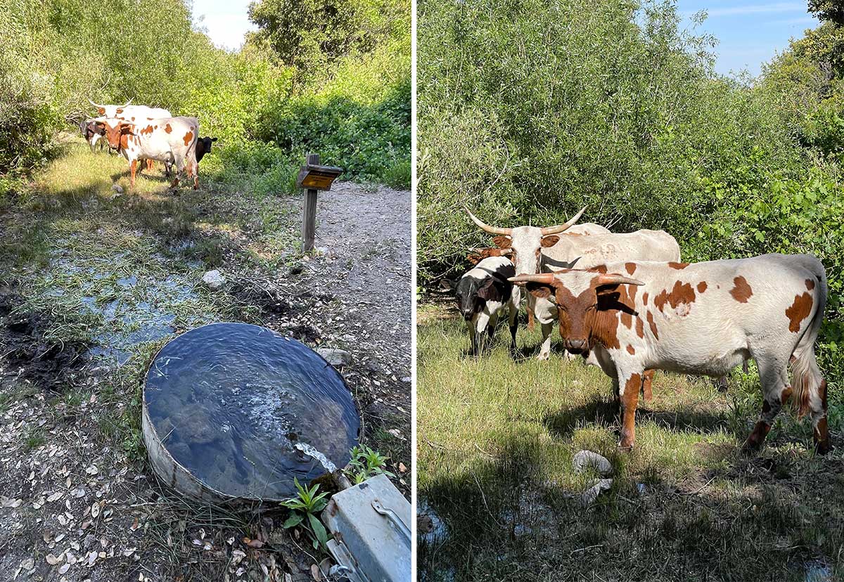
Cattle at Live Oak Spring
...these cattle had established themselves at the spring and it didn't feel like it was going to be a peaceful night's sleep there. However, they were kind enough to move away from the spring so we could get water.
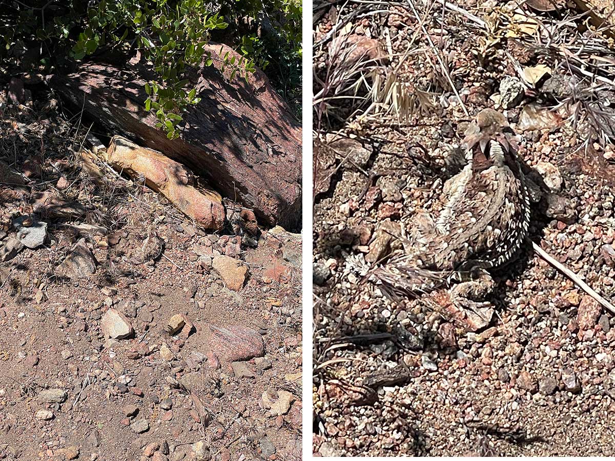
Horned Lizard
It always delights us to see a horned lizard on our desert trips. They are so well camouflaged, it can be difficult to spot them.
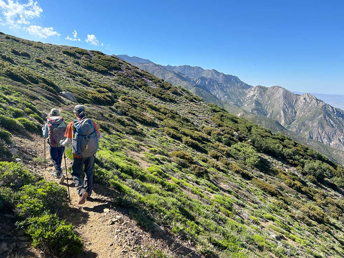
Hiking the Crest
The Pacific Crest Trail often travels high along the crest (i.e., the highest point of ridges), which is where it gets it's name. It means there is less water to be found along the trail (because you are above where water accumulates into streams and lakes) but the views are spectacular.

Wildflowers Along the Trail
By sheer luck, our trip coincided with the peak of wildflower blooms. This is a sampling of the flowers we saw. But wildflower blooms usually come with an abundance of insects, usually mosquitos. The mosquitos weren't too bad, and instead we experienced a lot of nasty biting flies that bit us through our clothing and caused big welts on our skin.
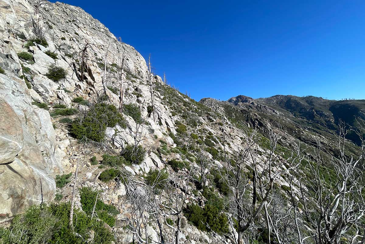
Burn Zone from the Mountain Fire
Eventually we reached the section of trail impacted by the 2013 Mountain Fire. A 25-mile section of the Pacific Crest Trail was closed for 5 years forcing hikers to walk a detour to get around it. It reopened in 2019, a year after Rob had walked the detour. He wanted to come back and see this section, which is what inspired this trip. There's a well written article about the hard work it took to reopen the trail.

The Dreaded Poodle Dog Bush
I had never heard of Poodle Dog Bush before Rob had hiked the southern desert portions of the Pacific Crest Trail. It's reputed to be worse than poison oak. If you accidentally brush up against it, you're likely to get a nasty rash and can even experience respiratory distress. We weren't expecting to see it in this section but it turns out it's a fire-following plant and essential to the recovery of the ecosystem.
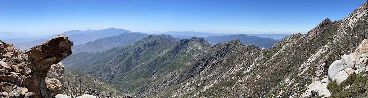
Panoramic View of Ridge
We had expansive views of rock formations and ridges while hiking through the fire zone, perhaps the only upside to the trees being gone.
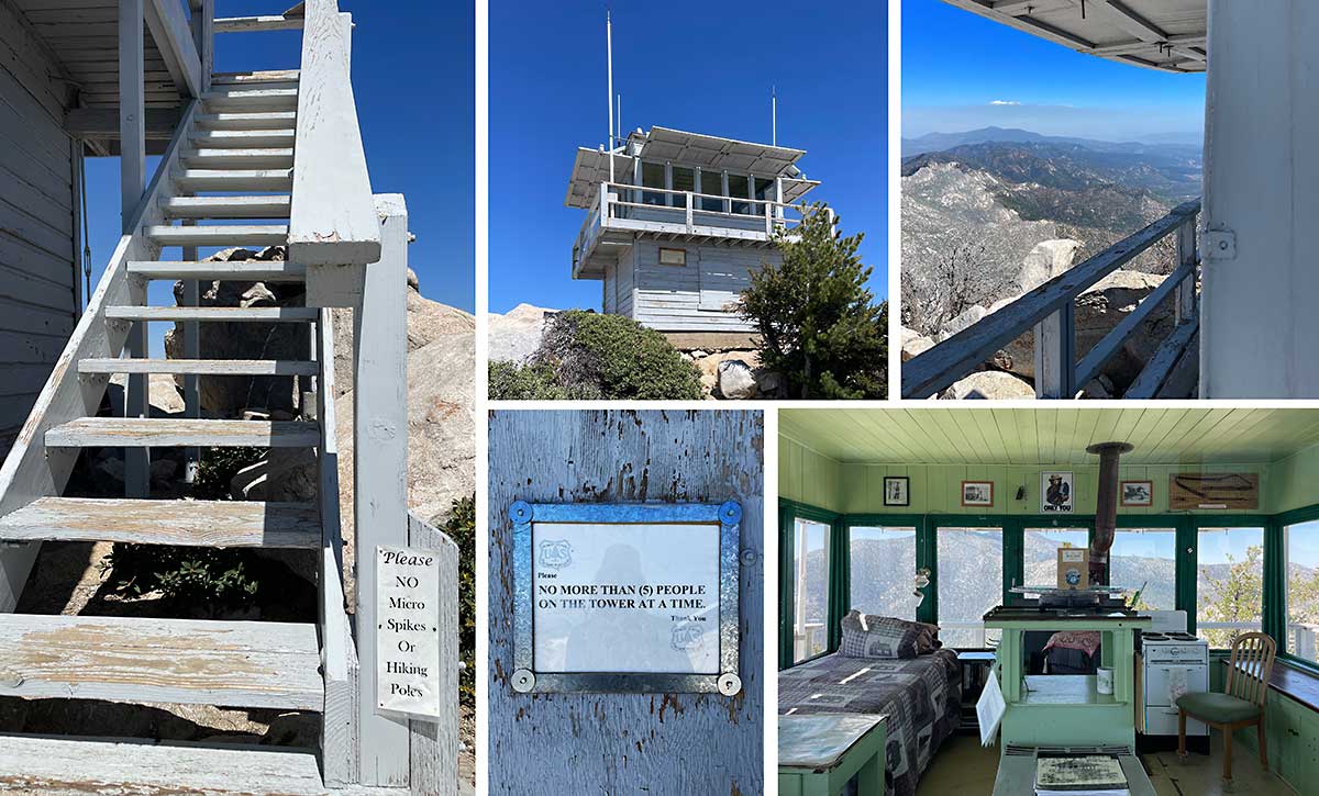
Taquitz Peak Fire Tower
At an elevation of 8,846 feet, this lookout is the highest within the San Bernardino National Forest. Built in 1937, it was the last active lookout in the San Bernardino National Forest when it was deactivated. Restored in 1998, it returned to service and is staffed sporadically by Fire Lookout Host volunteers. All work must be done with regular hand tools as no motorized equipment is allowed in wilderness areas. Photos clockwise from left: (1) Please NO Micro Spikes Or Hiking Poles sign on stairway (2) the fire tower exterior (3) view from the deck (4) lovingly restored interior complete with old-style non-motorized distance measurement tools (5) No more than (5) people on the tower at a time! (we did walk very gingerly on some of the deck floorboards that seemed at risk of falling through)
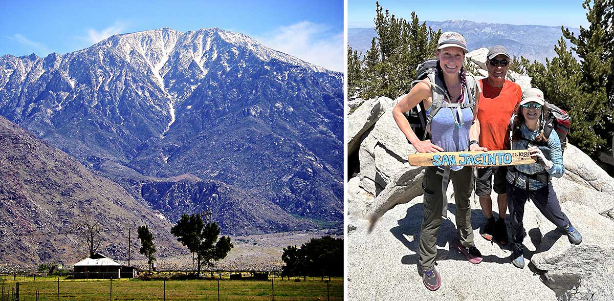
The Summit of Mt. San Jacinto
Mt. San Jacinto isn't a very distinct peak - it happens to be the highest point (10,834 feet) on a long range as shown in the photo on the right but from our approach, it simply felt like ascending a long ridge. Unlike most backpackers, we carried our packs to the summit. Most leave their packs at Saddle Junction, 5.5 miles from the summit and 2720 feet lower but it wasn't worth the hassle of stashing them in a bear-proof way.
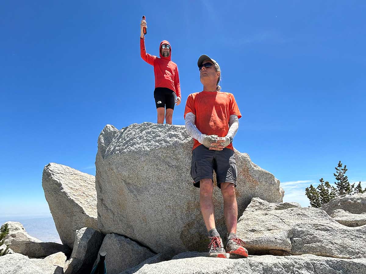
SanJacJon
While we were taking our summit photos, a trailrunner came up, acting as though he owned the mountain, pulled out some kind of viewing device and started looking around, totally photobombing us. So I struck up a conversation with him and asked him where he had run from. Instead of immediately answering my question, he let me know that he's summitted Mt. San Jacinto more times than anyone else alive. And then he told me that he had started at the Marion Mountain Trailhead and this was his second summit that day, he had already run all the way back to the trailhead and back to the summit when we saw him. I was blown away. Marion Mountain is the lowest trailhead, other than starting near Palm Springs, and involves a 4,000 foot climb. He then told us he maintains the SanJacJon website with Mt. San Jacinto weather and trail conditions. That triggered a memory of reading about him in the book Trail of the Lost by Andrea Lankford about a former park ranger's search for three men who vanished from the Pacific Crest Trail in separate but similar incidents from 2015-2017. It was like meeting a celebrity at the top of the peak. I later learned that he's 74 years old and I was further blown away by his fitness - what an inspiration!
Thank you for reading this far!
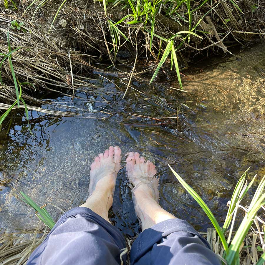
In closing, I leave you with a photograph of my favorite luxury on the trail: soaking my feet in a cold stream. We only encountered one stream on this trip (our other two water sources were springs) and I was grateful for the opportunity to give my feet a treat. They take the most abuse on the trail, walking on uneven terrain and carrying whatever additional weight I've brought along. Thank you for reading this all the way through!