Fossil Falls and Death Valley, March 23 – 26, 2025
We recently returned from a trip to Death Valley. We planned this trip long ago hoping to see wildflowers but the low rainfall this year meant zero wildflowers. Temperatures were unusually warm, over 100°F during the day and barely dropping below 80°F at night. Despite the heat, we got out on some beautiful hikes. The warm nights and the new moon made perfect stargazing conditions and one night we spotted an unusual bright orange fireball moving slowly across the sky - see the video below (warning: contains profanity) to learn what it was.
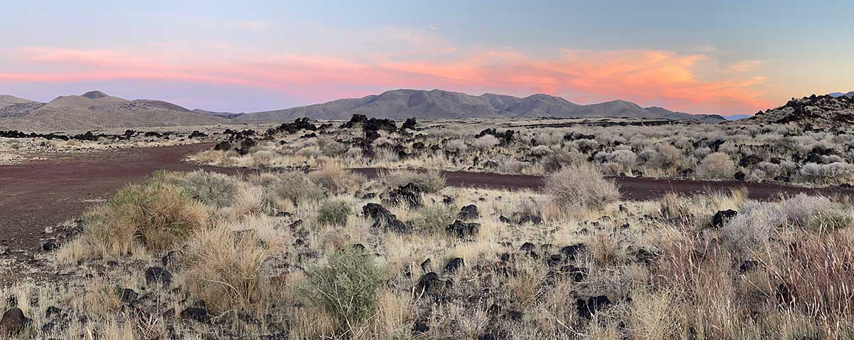
Sunset view from our campsite at Fossil Falls
Rather than spending a very long day driving from the Bay Area to Death Valley, we stopped earlier and found a campsite for the night in the BLM Campground at Fossil Falls where we had this beautiful view of the sunset
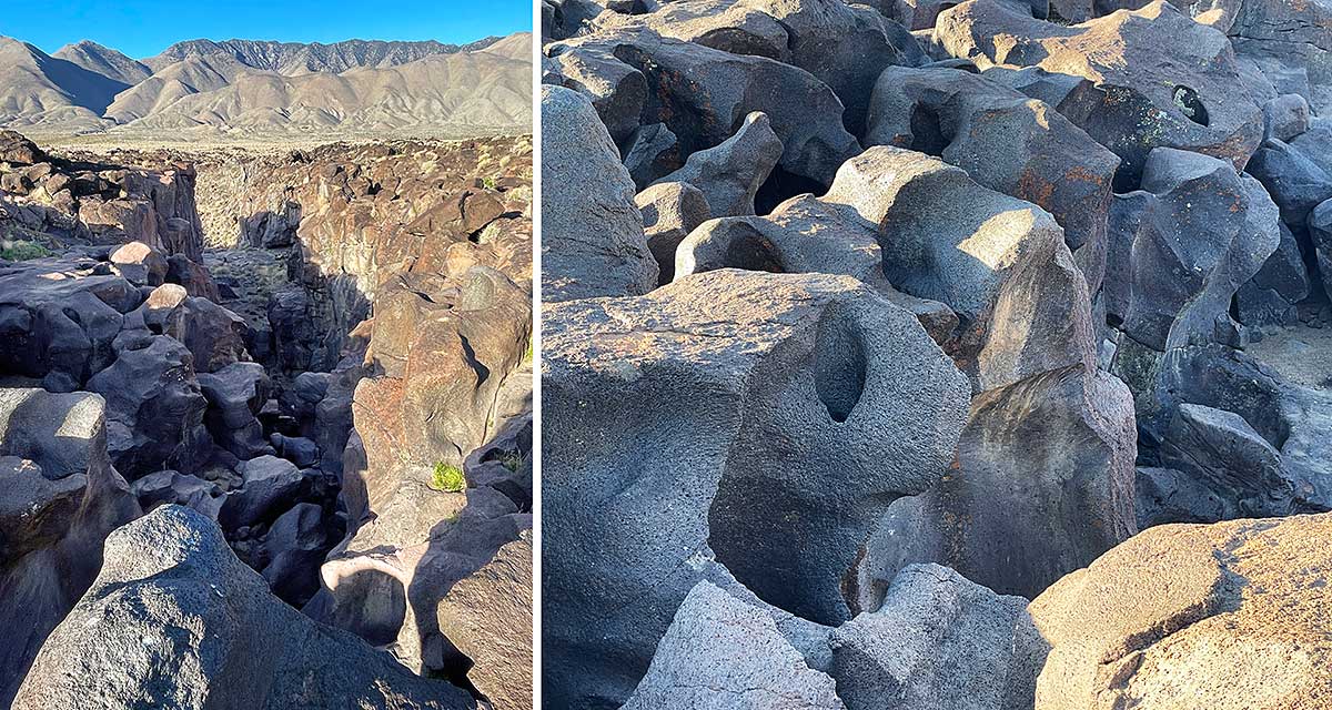
Fossil Falls
The next morning we took a short hike and explored Fossil Falls, named for an ancient waterfall formed by a combination of glacial melt and volcanic activity. During the last ice age, meltwater from glaciers in the Sierra Nevada cut a waterfall into this basalt flow, polishing and reshaping the rock into beautiful sculptural forms.
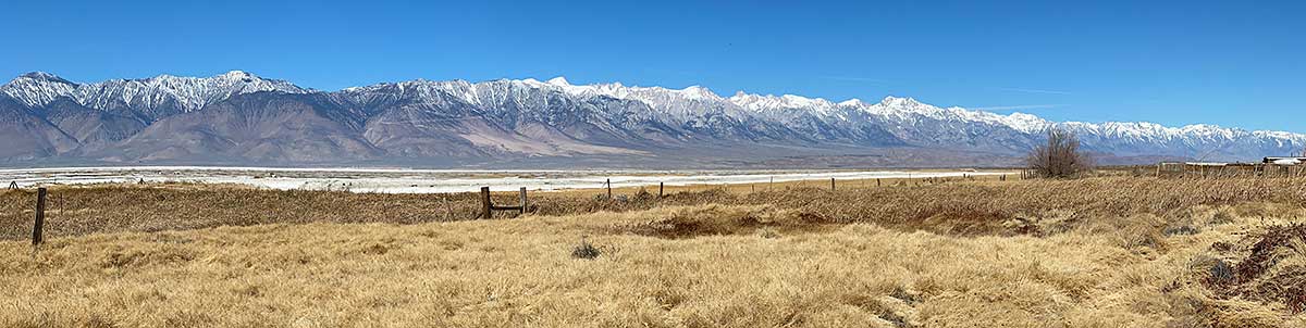
Eastern Sierra View
We stopped at the small town of Keeler on our way from Fossil Falls to Death Valley. Keeler is on the eastern edge of the former Owens Lake and has an expansive view of the Sierra Nevada. It was fun to see the zig-zagging road up to the Horseshoe Meadow trailhead, Mt. Langley, and Mt. Whitney, and so many other peaks.
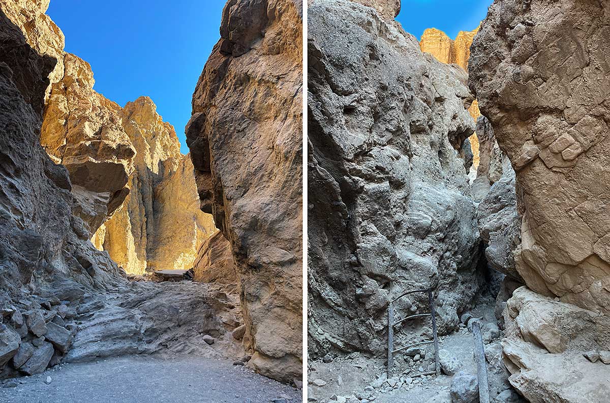
Golden Canyon
Because temperatures were forecast to be over 100°F the day we hiked Golden Canyon, we got an early start. The early morning light enhanced the golden hues of the rock (left). The canyon is continually being reshaped by flash floods, creating some fun rock scrambling sections. You can see an old metal ladder buried by gravel from a flash flood (right), so your only option now is a scramble through the rocks.
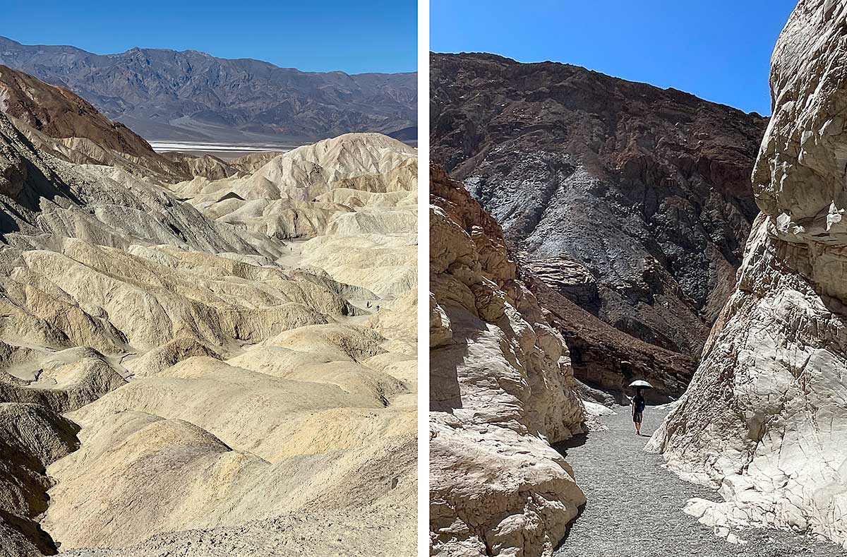
Views from the top of Golden Canyon
We continued from Golden Canyon to the Gower Gulch loop and hiked up 1,000 feet towards Zabriskie Point. Near the top you get views of the highly eroded terrain (left). To complete the loop back to the trailheard, we walked down this wash and were happy to have our silver reflective trekking umbrellas to keep us cool in the heat (right).
Fireball in the sky
We camped in a backcountry campsite along the Hole-in-the-Wall road on Monday March 24th. After dinner we sat outside in the warm evening air stargazing on a moonless night. Rob suddenly noticed what he first thought was a meteor but it was traveling very slowly and was orange in color, more like a fireball. It traveled parallel and close to the horizon and after 30 seconds it started disintegrating - I was only able to capture this short video of it. We had witnessed a similar but much brighter white fireball In 2016 while backpacking in Hetch Hetchy Valley in Yosemite that turned out to be an uncontrolled Chinese rocket falling out of orbit and re-entering the earth's atmosphere. This fireball was most likely debris from a SpaceX Dragon Rocket launch.
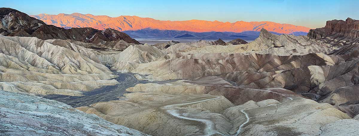
Sunrise at Zabriskie Point
Since we were on an early schedule to beat the heat, we headed over to Zabriskie Point to catch the sunrise and hiked down to join the portion of the Golden Canyon loop we had done the morning before.
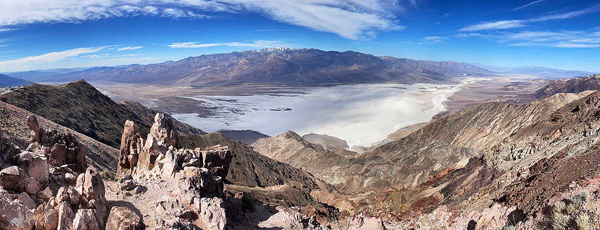
Dante's View
After enjoying the sunrise at Zabriskie Point, we drove to Dante's View and hiked up nearby Dante Peak where we got an even better view of ancient Lake Manly, Badwater and the Panamint Mountains with snow covered Telescope Peak in the center.
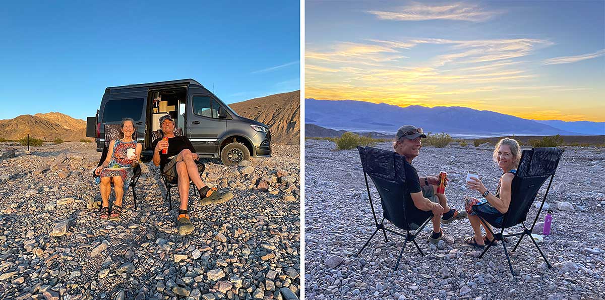
Echo Canyon Backcountry Campsite
Death Valley now requires you to reserve certain backcountry campsites and we were lucky to get the last available site in Echo Canyon for our final night in the park. Our site was a few miles up a rocky unpaved road and it had an expansive view of the valley below. Life is good when you can enjoy a nice beverage and a beautiful sunset. Thanks for following along with our trip!
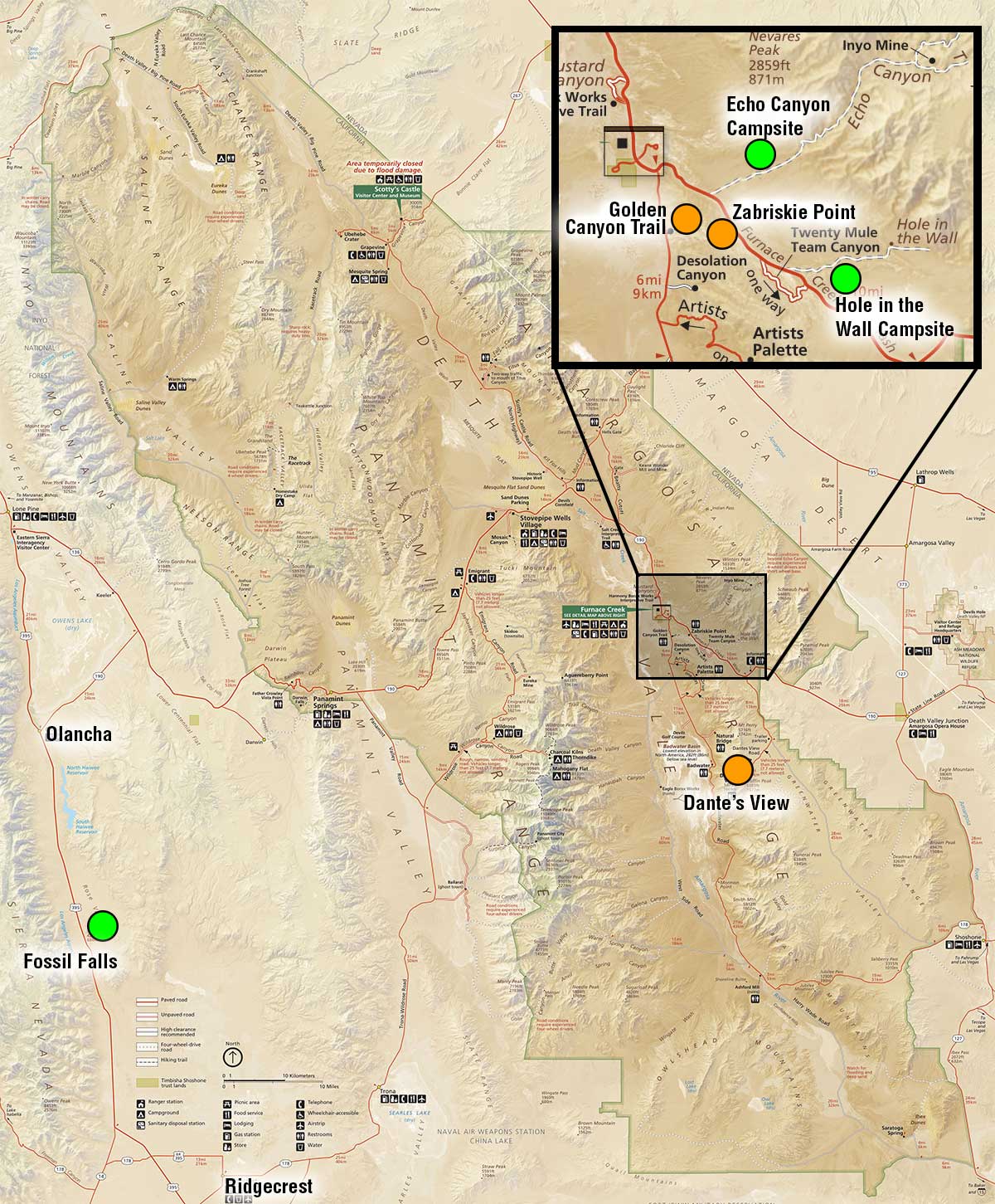
Death Valley Map
I've highlighted the places we camped in green and the places we hiked in orange on this map of the park.